VAUBAN
The area of Vauban is a neighbourhood in the outskirts of Freiburg, Germany. It was built on former French military barracks, encompassing an area of 38 hectares. This provides sustainable housing for 5,500 residents. The district provides many facilities, such as grocery stores, bike shops and farmers markets all within walking distance. Civic engagement and conscious living are a priority to the residents, and low energy construction is mandatory.
 TRAFFIC
Vauban is not currently car-free, however it encourages reduced car use. The concept behind limiting traffic involves a reduction in speed limits and parking spaces, resulting in quiet residential streets and a developed pedestrian path system. The district also offers good public transport, which was improved on the existing system in place.
ENERGY
Ecological aspects were incorporated into the neighbourhood’s development plan. Part of this was the obligation to build according to Freiburg standards: energy index of 65kWh/m²). 277 residential units took a step further, and were built in passive house construction: energy index of 15kWh/m². The heat supply for the entire district (with exception of the passive homes) is provided by a heat and power plant that runs on wood chips, and covers the needs of 700 households.
 GREENERY
Five new public green spaces were developed as part of the district. These create safe places to walk and play, and provide necessary ventilation to the project. Neighbours were involved in the creation of the designated green spaces, as well as the maintenance of the local trees.
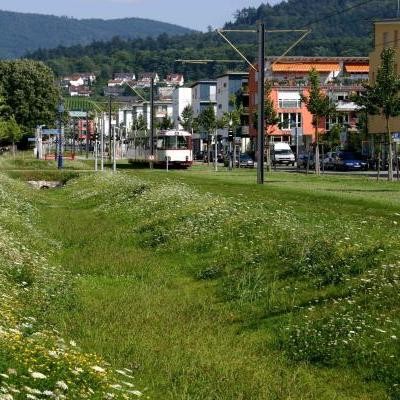
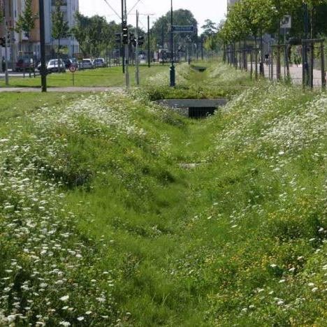
WATER
Rainwater is led to open channels and into central green trenches, which seeps into the natural ‘drain’ system. Some residents use cisterns to collect water and reuse it for other purposes.
 URBAN DEVELOPMENT
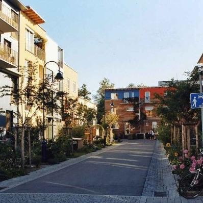
The concept for the urban design of the district was based on Wilhelminian quarters, broken up into individual rows. The houses are limited to 13 metres in height, and must have a 19 metre distance between house edge to house edge. In a few exposed locations, some residences have been built up to 25 metres, creating a local ‘beacon’ for the neighbourhood. Within the area, 20 hectares are of residential building land, 4.5 of mixed use and commercial, and 1.7 of public space.
The development plan was created with loose design regulations, in order to advocate for more flexibility and variability. Planning and design consultation was reduced to a minimum, as architects were heavily involved in the project. Plot sizes range from 162m² to 5,400m². The resulting mix of users adds to the identification of the district.